
Friday, April 13, 2018
Playground off Eaton Street (Eaton Parade), Laverton, Victoria

Thursday, April 5, 2018
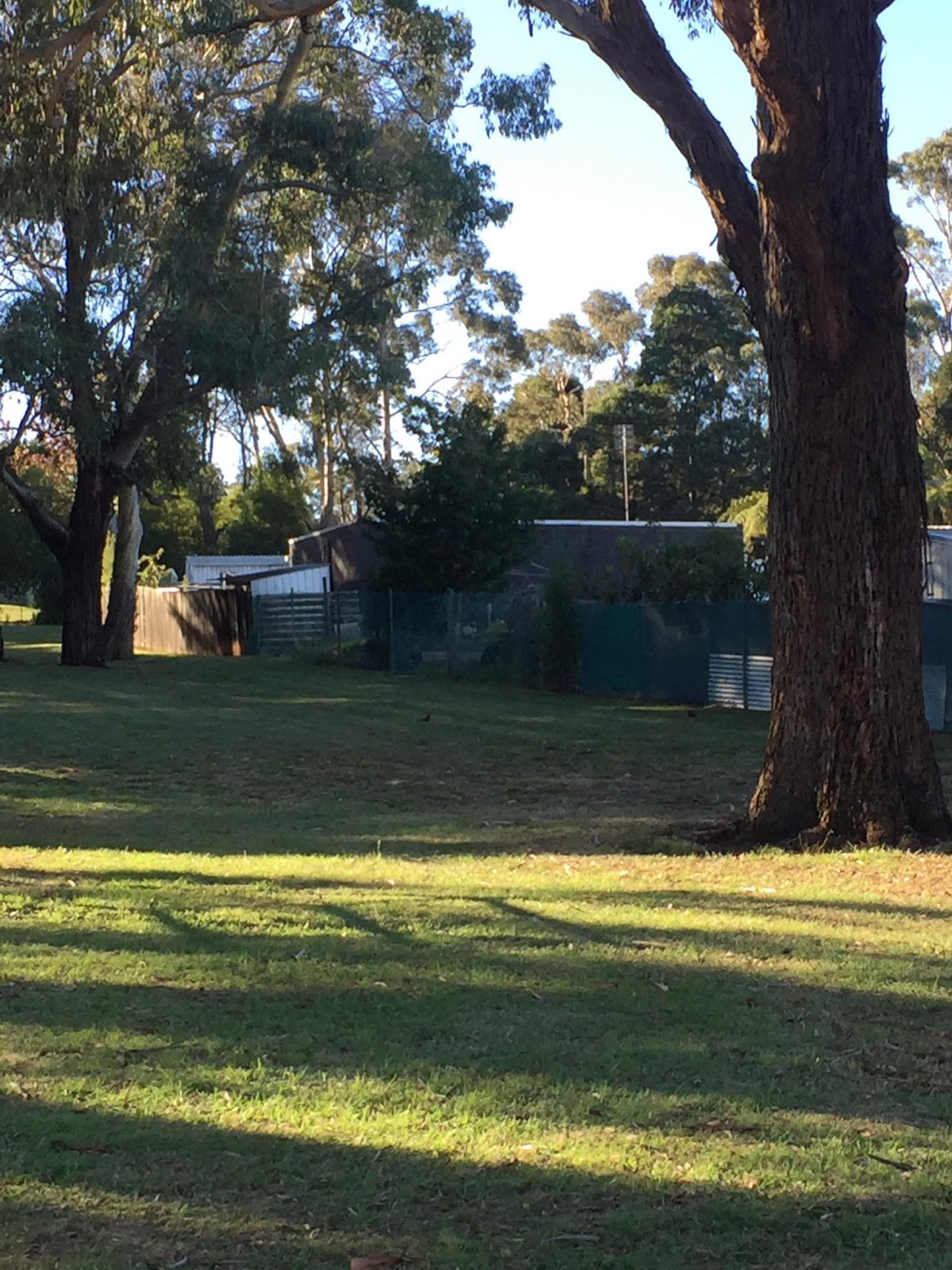
St Phillack Reserve, Rawson, Victoria

The internal reserve is most definitely a
feature derived from early 20th century town planning. Our
hypothesis, broadly speaking, is that the planners of that era were of the
opinion that internal reserves gave residents of planned environments agency to
shape not only their local public space but also the character and purpose of
their community. However, changes in both western society (from communal ideal
to individual, inward-focused family) and planning practice (little was built
or designed during the 1930s and 40s, meaning that many estates designed in the
1920s or earlier were still being populated in the 1950s) left residents at
best uncertain about the internal reserves they had inherited, and at worst
antipathetic towards them.
It is always surprising, then, when late 20th
century designs which are not directly related to new urbanism include internal
reserves. The small town of Rawson – 120 homes in less than 20 streets in the
west Gippsland area of Victoria, close to the well-known gold mining ‘ghost
town’ of Walhalla – was designed by Don Hendry Fulton and commenced in the late 1970s by the Melbourne Metropolitan
Board of Works, a long standing and for much of its existence very powerful
semi-autonomous state government body. Though this was almost certainly not
obvious at the time, the MMBW was at this point in its last decade of
existence.
Rawson was built to house those working on the
nearby Thomson Dam, with dormitories constructed for labourers and relatively
grand homes for professional staff. Rawson, at its peak, housed 1500 people, an
article in the Melbourne Age
by Barbara Fih (‘The town that is too good to stay
alive, Age 15 May 1985 p. 3) tells us. Fih also recounts that the MMBW ‘built a
25-metre swimming pool, squash courts, three tennis courts, a shopping centre,
oval, recreation hall with a basketball court in it, a primary school and
reserve.’ The town ran at capacity for two years until May 1983, when the dam
was opened after which the population quickly dwindled and the houses were sold
off. Public services were opened to tender with the MMBW: the local petrol station,
as one example, was advertised as available for lease with the option to
purchase (The Age, Wednesday 20 June 1984, p. 28).
The ‘reserve’ Fih mentions is probably not the
internal reserve of interest to this blog, but a sports and recreation reserve on Tyers-Walhalla Road. Even Google Maps seems
resistant to recognizing the St Phillack Reserve, which is however featured on
Baw Baw Shire’s website and noted for featuring a ‘playground’ and ‘walking
trails unpaved’. Which is all true! However, confusingly, the reserve is not
zoned as open space (though clearly used and, as mentioned, labeled as such).
The space is best described as an off-street
children’s playground and dog park (though in truth the streets of Rawson seem to be rarely
troubled by traffic). The play equipment, though not new, is in good condition.
What is perhaps most interesting about the site in terms of its design is that
it features a large number of old and tall trees, and while no doubt the entire
Rawson area was until quite recently covered in similar vegetation, in this
instance it is clear that the decision was made that an interior park space
would be an opportunity to retain trees on site.
Many of the local homes feature transparent
(usually, chicken wire) back fences and many also have gates into the reserve,
which has three entrances. Cooper’s Creek ‘begins’ immediately south of the St Phillack Reserve
but does not appear to have ever run through the land the reserve is currently located
on.
A note about names: The name St Phillack is
apparently that of a mountain. The nearby street Von Meuller Drive commemorates
noted landscape gardener and botanist Ferdinand von Mueller (note – the
commemoration misspells his name!) who climbed Mount Baw Baw. Another nearby
mountain, Mt. Selma, is the inspiration for Selma Drive. Other streets recall
the area’s gold mining history: Morning Star Crescent is named for the Morning
Star Gold Battery site, a significant heritage location proximate to Walhalla,
and Little Boy Crescent the goldfields tramway of that name. Stander Drive is
after a creek. The town itself is named for a local landowning family; it was a
source of some controversy at the time of creation, as the MMBW favoured the
name Robertson after chief engineer A. G. Robertson (some locals are reported in a 1979 Age article to have favoured
Parker Corner, apparently an extant local place name - though MMBW advertising from the late 1970s renders this as Barker's Corner) (Steve Harris and Kerry
Wakefield, ‘Town hits problems’, Melbourne Age 26 April 1979 p. 13).
View it here. More pictures below.


Thanks to the redoubtable Victoria Kolankiewicz for extensive work on this post, including locating the reserve in the first place.
Friday, February 23, 2018
‘The Deeplish Study’ 1966
This case study of ‘environmental
improvement’ (its subtitle is ‘Improvement possibilities in a district of
Rochdale’) contains a number of examples of recalibration of 19th
century urban environments to provide open space in what we would typify as
‘internal reserve’ style. The area is known as Deeplish, in the south of Rochdale,
Lancashire.
‘The houses are usually clean and neat… But
unmade roads, ill-kept back alleys, allotments, derilect land, old broken
walls, groups of garages, the dirty brook and some untidy buildings contribute
to a generally run-down impression… it looks as though the people responsible
for various parts of it have given up trying to make it look attractive’ (p.
2). There is considerable discussion of derilect and/or allotment land used for
children’s play (p. 10 passim). The author(s) also state, tellingly, that when
asked their opinion about ‘outdoor play facilities for children… they expressed
the easily articulated demand for a children’s fitted playground… The mothers’
main worry was the danger to children from traffic. (p. 30).’
Having set up the problems inherent in a
place such as ‘Deeplish’, the study then goes on to imaginatively suggest a
range of redesign options. Many of these include what we would call (but it
doesn’t) internal reserves. ‘For the smallest children,’ it says, ‘play space
has to be very close to the houses and in a district where back access to the
houses is common it can be combined with a broader and improved back walk’ (p.
49)’. This is reiterated on p. 61, in a discussion of one particular sector
where ‘the opening up, paving and lighting of the back walks would render these
suitable for toddlers’ playgrounds within sight of their homes’.
I have presented here two images of many.

The image above

This image, which conforms more
closely to the kind of space we’re interested in, is not really described in
the text, although there is discussion of improvement of waste land generally,
for instance thus:
‘An area may also be greatly improved by
the planting of trees, the removal of unsightly fences and sheds and the
landscaping of spare patches of land. The local authority can also take a lead
in promoting a scheme for the particular benefit of a group of houses by
agreement among owners.'
Another, very familiar trope is canvassed in this same paragraph:
'But vandalism is a problem, and unless the vigilance of local people can be enlisted in looking after what is in fact part of their living space, the life of new trees, seats, swings etc., may be short’ (p. 50).
Another, very familiar trope is canvassed in this same paragraph:
'But vandalism is a problem, and unless the vigilance of local people can be enlisted in looking after what is in fact part of their living space, the life of new trees, seats, swings etc., may be short’ (p. 50).
Oh, and um...

Friday, January 19, 2018
Kingswood Centre, Basildon UK

'Following one footpath in an easterly direction one comes on an extensive lawn sprinkled with trees and containing in one part the various odd objects of a children's playground. Some of the houses front on to this open space, others have their small walled or white-fenced gardens adjoining it.'
Thursday, December 21, 2017
Whiteley Village
From Sarah Rutherford's Garden Cities (2014), pp. 61-4.
'Whiteley Village was a unique self-contained retirement village. The site was bought in 1911 and the buildings constructed from 1914 using a £1 million bequest by William Whiteley, the murdered philanthropist and owner of the London department store Whiteley's. Set deep in Surrey woodland, near Cobham, it was planned in eight segments around an octagonal village centre with a monumental centrepiece. It was built to the highest quality with designs by seven of the most prestigious Arts and Crafts architects of the day including Reginald Blomfield, Aston Webb and Ernest Newton. As a pioneering community, self-sufficient in its facilities for retired persons, it housed all classes as long as they were of good character and sound mind, unaffected by any infection diseases, nor convicted of any criminal offence.' View it on google maps here.

 In case you're interested (why wouldn't you be?!) Whiteley was shot at point-blank range in his shop in 1907 by a man he had been arguing with. The man claimed to be his son, Cecil, and although the Whiteley family initially denied all knowledge of him it later came out at trial that Cecil Rayner had in fact been born to William Whitely and Emily Turner out of wedlock in 1885 (Manchester Guardian 25 July 1907 p. 7; Manchester Guardian 23 March 1907 p. 10). The £1 million was about two-thirds of Whiteley's estate. He had left a small amount additionally to provide for Rayner's mother, Emily, and her sister Louise. The Whiteley murder was sufficiently notorious that another shooting of a 'natural father' by his son, in Paris in 1912, was referred to by some newspapers as a 'Whiteley tragedy' (see Geelong Advertiser 20 May 1912 p. 3).
 Smith's Weekly, 5 July 1919 p. 9
'Whiteley Village was a unique self-contained retirement village. The site was bought in 1911 and the buildings constructed from 1914 using a £1 million bequest by William Whiteley, the murdered philanthropist and owner of the London department store Whiteley's. Set deep in Surrey woodland, near Cobham, it was planned in eight segments around an octagonal village centre with a monumental centrepiece. It was built to the highest quality with designs by seven of the most prestigious Arts and Crafts architects of the day including Reginald Blomfield, Aston Webb and Ernest Newton. As a pioneering community, self-sufficient in its facilities for retired persons, it housed all classes as long as they were of good character and sound mind, unaffected by any infection diseases, nor convicted of any criminal offence.' View it on google maps here.


Wednesday, December 20, 2017
Sutton Garden Suburb

F. C. Pearson's work on this design is discussed by Rutherford as having 'many features established by Unwin... The integral communal spaces enclosed by houses are now threatened by development in many such suburbs'.
The suburb was (according to Wikipedia) developed under the aegis of Thomas Wall, of Wall's ice-cream fame.
View it here. For orientation, the link will take you to Oak Close, which is the top right-hand corner of the subdivided area.
Tuesday, October 31, 2017
Maidstone Land Subdivision
'The Commission has given consideration to the extremely undesirable conditions obtaining in existing subdivisions in a tract of country at Maidstone in the Shire of Braybrook.
'Nearly all of the subdivisions in this area were surveyed many years ago during a land boom. In the village of Maidstone and its vicinity many of the allotments measure 26 feet frontage by 66 feet depth a superficial area of 1,758 square feet!
'Although the Shire of Braybrook has a bylaw which prohibits a repetition of such small allotments, no power exists which will permit amendments being made to conditions existing prior to the passing of this by-law. The Shire of Braybrook has taken steps as opportunity has occurred to secure tow or more allotments and in other ways in an endeavour to prevent the perpetuation of unsatisfactory conditions which would arise if the original allotments were built on. Without effective legislation very little can be done, especially with regard to main traffic routes, reserves, zoning, building regulations, from a health point of view, etc. etc.
'The Commission suggests, as a basis of discussion, that action be taken to secure legislation to have the whole are [sic] resubdivided in accordance with modern town planning principles. It is probably that if this area were replaced the gross are which would be available for housing purposes would be little less than that now available on account of the existing subdivision being wasteful and extravagant in the provision of useless streets. If this action were taken, the present property owners could then be given approximately the same area of land in a similar location to that held by them prior to resumption.
'The preparation and carrying out of the scheme could be entrusted to a town Planning Department acting in conjunction with the Shire of Braybrook.'
'Notes for Conference with Williamstown and Footscray City Councils and the Braybrook Shire Council - to be held at Footscray Town Hall, at 8 p.m., 3rd June, 1926.' in 'Footscray- City A/F 2' folder, MTPC archives, Public Records Office Victoria box no. 10281
'Nearly all of the subdivisions in this area were surveyed many years ago during a land boom. In the village of Maidstone and its vicinity many of the allotments measure 26 feet frontage by 66 feet depth a superficial area of 1,758 square feet!
'Although the Shire of Braybrook has a bylaw which prohibits a repetition of such small allotments, no power exists which will permit amendments being made to conditions existing prior to the passing of this by-law. The Shire of Braybrook has taken steps as opportunity has occurred to secure tow or more allotments and in other ways in an endeavour to prevent the perpetuation of unsatisfactory conditions which would arise if the original allotments were built on. Without effective legislation very little can be done, especially with regard to main traffic routes, reserves, zoning, building regulations, from a health point of view, etc. etc.
'The Commission suggests, as a basis of discussion, that action be taken to secure legislation to have the whole are [sic] resubdivided in accordance with modern town planning principles. It is probably that if this area were replaced the gross are which would be available for housing purposes would be little less than that now available on account of the existing subdivision being wasteful and extravagant in the provision of useless streets. If this action were taken, the present property owners could then be given approximately the same area of land in a similar location to that held by them prior to resumption.
'The preparation and carrying out of the scheme could be entrusted to a town Planning Department acting in conjunction with the Shire of Braybrook.'
'Notes for Conference with Williamstown and Footscray City Councils and the Braybrook Shire Council - to be held at Footscray Town Hall, at 8 p.m., 3rd June, 1926.' in 'Footscray- City A/F 2' folder, MTPC archives, Public Records Office Victoria box no. 10281
Subscribe to:
Posts (Atom)
Ohvitseride (Officer's) Park, Tartu, Estonia
You can find it here . I visited on 8 July 2026. Estonian wikipedia says: The park covers an area of 8,424 m² and formerly served as the ...

-
 Significant portions of the Netflix series Deadwind (known in Finland as Karppi) were filmed - I'm 99% certain - in Puu-Käpylä. I can...
 -
 Comparison between the above from a relatively new UBD street directory and the current Google Map shows some disparity in the shape of t...
