Wednesday, December 30, 2020

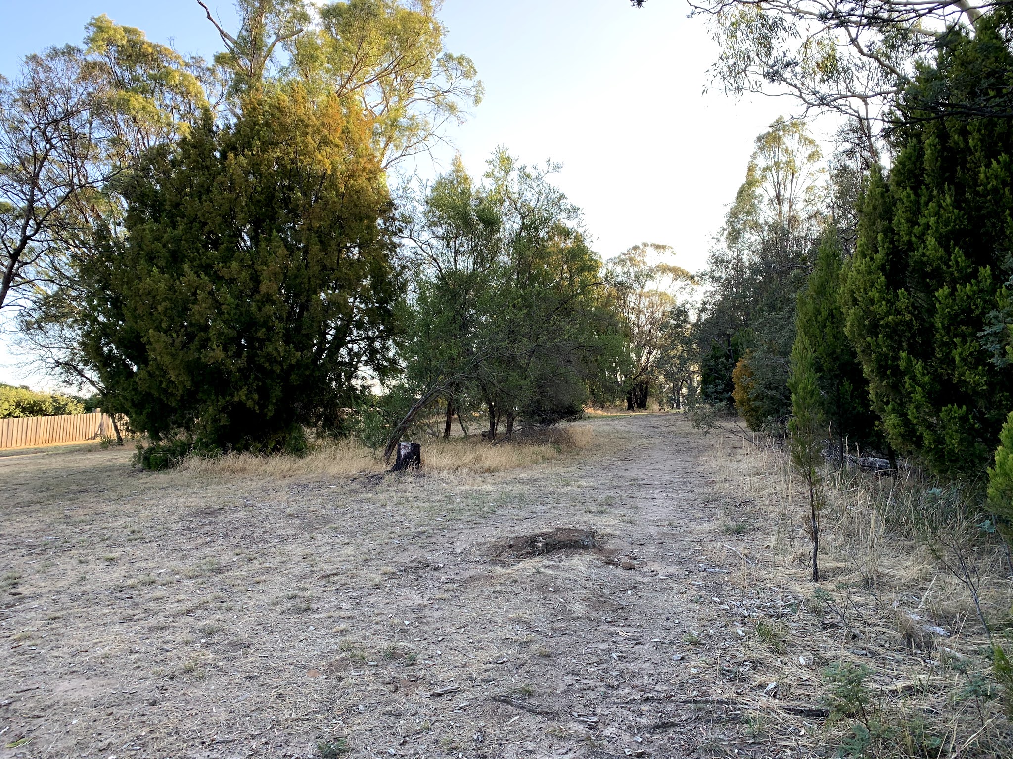
Kalinda Modified Urban Forest, Kalinda (North Ringwood) Vic

‘Marica Close, North Ringwood, seems like just another short, dead-end street when the visitor turns into it' wrote journalist Graham Betley in 1992. 'But at the top of the rise a whole new vista opens up.

‘The street ends at the boundary of the Kalinda modified urban forest, an eight-hectare area of parkland with a central rotunda. The views over the park extend all the way to Mount Dandenong.’ 
Graham Betley ’Uninterrupted views of magnificent backdrop’ Melbourne Age 12 August 1992 p. 37

Kalinda - if that really is a place name and it's not just North Ringwood - only became properly suburbanised in the late 20th century and I think it's fair to assume that the Kalinda Modified Urban Forest owes its existence to local concern about the elimination of treed open space for the sake of the luxurious houses erected hereabouts. A plaque in the space (which I didn't actually see, but of which the article linked below contains a photograph) says the first plantings were in 1988.* 
This (above) is what I suppose you'd call the main entrance at Marica Close, though there is also a pathway entrance from Holroyd Crescent (below): 
Below: a bunch of fences on the north side of the space, almost all with gates leading in:

(To be honest I can't even see the gate in this fence, above, but I wouldn't have taken the picture if there wasn't one!)


Above: Looking towards the centre of the space. 
Above: Holroyd Cres end looking north
Above: Holroyd Cres end looking south
Above: The fence dividing the space from the school grounds at the east end. 

Above: And from just within the school grounds, looking in to the space. (BTW it was two days before Christmas, school holidays!).

I didn't go to the south boundary of the fence as the woman with the dog you can see in a couple of the pictures was in that area and as should be clear by now, to not mess with members of the general public is one of my mottos. 

A fairly similar stroll to mine is captured here, but as mentioned above I didn't see the commemorative plaque.

Google maps link.

* I can't find any information anywhere about the Friends of Kalinda, mentioned on the plaque, but there is a character called Kalinda in The Good Wife and she has friends, so naturally this reality would push out anything else to do with a Melbourne suburb, friended or otherwise. 

Saturday, December 26, 2020

Bluegum Park, Youngtown, Tasmania

It is difficult to upload my 2002 photos of Launceston internal reserves as they are glossy prints more suitable to scanning than re-photographing, which is all I'm able to do in the current pandemic. Here are four images of Bluegum Park from 9 February 2002. 


And here are images of the same space on 6 February 2020: 


 Locate it here

Tuesday, December 22, 2020

Reserve between Miller St, David St and Syme Crescent, O'Connor, ACT

View it here

This is apparently the only survivor of the umpteen internal reserves the Griffins originally intended to sprinkle throughout Canberra. How it came to be built and how it has come to survive is a mystery. Its interior has a very pleasant rural atmosphere and evidence of occasional, but not concerted or frequent, use. 

Syme Crescent - the lamppost signifies the entranceway. 
Entrance. 


Same entrance - there's only one, apart from gates from backyards. 

Visited 8 December 2020. 

Friday, November 27, 2020

18 Lennon St. Parkville, Victoria, Australia

Melbourne Age 6 July 1988, p. 34. 


The first newspaper mention I have found of this development is the Melbourne Age for 3 Feb 1971 (p. 31) in a listing for a one bedroom flat with a 'garden setting'. It's 'freshly painted', which suggests that it's not a new building (and in any case, it's only one advertised of a much larger development). 'Freshly painted' always makes me think that something terrible has happened there but that's just me. The way in which 18 Lennon St has existed for most of the last 50 years has in any case been I think completely dominated by the Tullamarine Freeway. 

You can see Lennon St innocently sitting there enjoying the babbling brook of Moonee Ponds Creek and without an inkling of what is about to hit it when the freeway finally comes through. This is from the Melways 1966. Try to reconcile the above with this. Google Earth has trouble even finding Lennon St in that mess, and as for 18 Lennon, it really has no frontage anymore (I suppose it's possible that the wall you see in the above image, taken a couple of days ago, once fronted a street; now it fronts a human-scale fence which fronts a massive wall which shields the people of Lennon st from a Tullamarine Freeway off-ramp). This is it in 1971:

To me the issue is probably ultimately: since the 18 Lennon development probably dates from the late 1960s, did the people who created it know that it was going to be facing onto a freeway (I'm guessing it wasn't walled off until much later)? Is the open space to kind of mitigate the noise/fumes from the freeway? 

Another question I have, which has nothing to do with internal reserves, is: was this development hedging its bets about the value of being so close to the freeway (and thereby, the airport - probably ten minutes away in the early 70s)? 

The 18 Lennon St space is, incidentally, quite well maintained and seems like a peaceful enough enclave, notwithstanding the extreme awkwardness of its positioning/access. I would have liked to show you some images of how the units face into the space but they have big windows, it seems invasive to residents to photograph. It has presumably always been rental (don't quote me on that). 

Sunday, August 30, 2020

lewis mumford (1960) re: internal park space

'Now the great function of the city is to give a collective form to what Martin Buber has well called the I-and-Thou relation: to permit – indeed to encourage – the greatest possible number of meetings, encounters, challenges, between varied persons and groups, providing as it were a stage upon which the drama of social life may be enacted, with the actors taking their turn, too, as spectators. The social function of open spaces in the city is to bring people together; and as Raymond Unwin demonstrated at Hampstead Garden Suburb – and Henry Wright and Clarence Stein even more decisively at Radburn – when both private and public spaces are designed together, this mingling and meeting may take place, under the pleasantest possible conditions, in the neighbourhood.' (p. 20)

'When I ask myself what immediate improvement would make my own city, New York, even more attractive to live in again, I find two answers: rows of shade trees on every street, and a little park, even a quarter of an acre, in each block, preferably near the middle. When I think of another familiar city, Philadelphia, I would turn the back alleys into green pedestrian malls, threading through the city, now widening into pools of open space surrounded by restaurants, cafes or shops, all insulated from motor traffic. And what applies to individual blocks applies to neighbourhoods. To have any value for recreation they, too, must be insulated from the traffic avenues and motorways: the parts of the neighbourhood should be joined together by green ribbons, pedestrian malls, and pleasances, such as that admirable park Olmsted designed for the Back Bay Fens of Boston, taking advantage of a little river and a swamp to create a continuous band of green, uniting more than one neighbourhood.’ (p. 21)


The one great requirement for open spaces in urban centres is to insulate them from the fumes, the noise, and the distracting movement of motor traffic. The neighbourhood, not the individual building block, is now the unit of urban design, and all fresh schemes for both open spaces and for traffic, to be worthy of approval, must separate the pedestrian completely from the motorcar. When this can be done from the beginning as was first decisively achieved at Radburn, New Jersey, the motor roads that give access to buildings may be reduced in area and partly eliminated; while the space that is so saved within the superblock and the neighbourhood may be dedicated to a public park.’(p. 21)


Lewis Mumford, ‘The Philosophy of Open Space’ [reprinted from The Highway and the City 1960] Whitney North Seymour (ed) Small urban spaces; the philosophy, design, sociology, and politics of vest-pocket parks and other small urban open spaces New York : New York University Press, 1969

Wednesday, July 1, 2020

Helenwood Grove Park, Newnham, Tasmania

I'm finally getting around to posting my images from Launceston, February this year. I hope you weren't holding your breath. 

Here you can find a 1970 image from the Tasmanian Town and Country Planning Commission. I don't know whether this is a map or a plan (i.e. was the space planned in 1970?). 


The first four pictures here are of my visit to this space on 9 February 2002.* 


The last two above are the laneway between the reserve and Franmaree Road. There is another lane, between the reserve and Helenwood Grove, which apparently I didn't photograph in 2002 (perhaps I didn't know it was there...!). Below are the images from February 2020, starting with the Helenwood Grove lane. All I can really say is that the trees are bigger and the playground equipment (from memory - not sure why I didn't photograph this properly?! has been updated.


 This is the laneway to Franmaree Road.
Last year, Cypress Hill, the Californian hiphop group which has sold 20 million records since formation in 1988, finally received its star on the Hollywood Walk of Fame. I wonder if its members are aware of the resilient and omnipresent grass roots tribute paid to it on this wall in Helenwood Grove Park.  It has served as acknowledgment of the popularity of the group (and, you'd have to assume, its ongoing advocacy of marijuana use) for decades now. 

The space is viewable here.

* My photos from 2002 are labelled 'Helenwood Gve, Alanvale'; Newnham is a portion of Alanvale. It's possible the internal reserve itself had no name at this time; it is presently known as 'Helenwood Grove Park' by the City of Launceston.

Ohvitseride (Officer's) Park, Tartu, Estonia

You can find it here . I visited on 8 July 2026.  Estonian wikipedia says: The park covers an area of ​​8,424 m² and formerly served as the ...